EMBRACE THE MAJESTIC IN SWITZERLAND
An Awe-Inspiring Hiking Retreat for Women Only in the Jungfrau Region!
June 25 - July 3, 2025
9 days / 8 nights
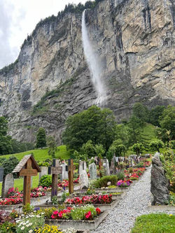
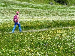
Discover the stunning beauty of the Jungfrau region in Switzerland, the ideal destination for an unforgettable hiking retreat. Nestled in the heart of the Swiss Alps, this extraordinary area boasts majestic peaks, massive glaciers, lush green valleys adorned with colorful wildflowers, serene alpine lakes, and an abundance of waterfalls, providing an inspiring backdrop for every hike. Share the magic of the journey and savor the breathtaking views with new and old friends. We’re sure to return with lasting memories, plenty of inside jokes and sore cheeks from all the laughter. The Jungfrau region blends natural splendor with charming Swiss hospitality, offering a hiking experience that is both enriching and truly unforgettable.
 |  |  |  |
|---|---|---|---|
 |  |  |  |
 |  |  |  |
 |  |  |  |
 |  |
Kirchbühl Hotel
Kirchbühl Hotel in Grindelwald offers a perfect blend of Swiss hospitality and modern comfort. This 4-star hotel, located peacefully on a hill just above the town, provides stunning, unobstructed views of the surrounding Alps. Its tastefully decorated rooms and suites, along with the 3-star apartments, create a tranquil sanctuary for relaxation after a day of exploration. Guests can unwind in the wellness area, enjoy the cozy lounge, and savor gourmet dining featuring local and seasonal flavors. Ideally situated, the Kirchbühl Hotel provides easy access to local trails, gondolas and lifts, as well as some of the region’s most spectacular hikes via the incredible Swiss railways.


Food & Bar
Breakfast is a delightful affair with a buffet of freshly baked breads, cheeses, cold cuts, seasonal fruits, granola, yogurt, and hot dishes made to order. We start our day in the panoramic dining area with magnificent views of the Alps. For lunch, we’ll either dine at the charming mountain restaurants or huts along the trails or enjoy a packed picnic. After a day of hiking, treat yourself to complimentary afternoon tea and cake, served daily between 4 – 6 p.m. in the cozy hotel bar and lounge. In the evening, savor a thoughtfully curated 3- course menu showcasing local and seasonal ingredients that highlight the flavors of Swiss cuisine. The elegant dining room has a warm, inviting atmosphere, perfect for enjoying expertly prepared meals and delightful wines with our fellow travelers.


Hiking, Itinerary & Transportation
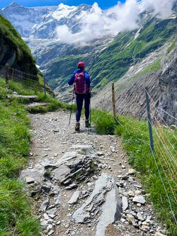
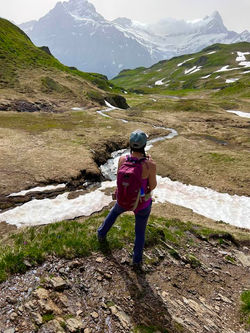
Our hikes are carefully chosen to showcase the best of the Jungfrau region, featuring stunning panoramas, majestic peaks, massive glaciers, lush green valleys dotted with colorful wildflowers, serene alpine lakes, and numerous waterfalls. Expect a diverse and enriching hiking experience.
Distances and Elevation: Hike distances and elevation gains will vary (please see specifics below).
Transportation to the Hikes: We’ll use Swiss transportation, including modern trains, cogwheels, gondola, lifts, and cable cars, to access our hikes and explore charming Swiss villages. Some excursions will involve nearby lifts, while others may take 90 minutes to 2 hours, with a few stops along the way. Although this might sound extensive, traveling through Switzerland’s breathtaking landscapes is truly a highlight and is surprisingly relaxing. This efficient transport grants us access to remote locations and high elevations that would otherwise be inaccessible by car or foot!
We’ll each purchase an 8-day Berner Oberland Pass, which covers almost all our transportation needs and eliminates the need for individual train and lift tickets. This pass is the best deal in Switzerland and allows us to hop on and off seamlessly.
Rest assured, your luggage and you will be transported in style to and from the airport in a private, air-conditioned van.


Important Information
An adventurous and flexible spirit is essential! Although we’ll follow an itinerary, please be prepared for adjustments based on weather conditions. Rain is common in the Alps, usually occurring in the afternoons or evenings. We typically plan to depart the hotel around 8 a.m., but on some days, we may need to head out as early as 6 a.m., taking breakfast to go, to complete our hike before a storm and to beat the crowds. We’ll adjust our hikes to take advantage of the most favorable weather, but please be aware that we may need to cancel a hike for safety reasons if necessary. Ultimately, our schedule will depend on the weather.
Hike Details: PLEASE READ CAREFULLY!!
Our hikes are carefully chosen to showcase the best of the Jungfrau region, featuring stunning panoramas, majestic peaks, massive glaciers, lush green valleys dotted with colorful wildflowers, serene alpine lakes, and numerous waterfalls. Expect a diverse and enriching hiking experience.
Distances and Elevation: Hike distances and elevation gains will vary (please see specifics below).
Transportation to the Hikes: We’ll use Swiss transportation, including modern trains, cogwheels, gondola, lifts, and cable cars, to access our hikes and explore charming Swiss villages. Some excursions will involve nearby lifts, while others may take 90 minutes to 2 hours, with a few stops along the way. Although this might sound extensive, traveling through Switzerland’s breathtaking landscapes is truly a highlight and is surprisingly relaxing. This efficient transport grants us access to remote locations and high elevations that would otherwise be inaccessible by car or foot!
We’ll each purchase an 8-day Berner Oberland Pass, which covers almost all our transportation needs and eliminates the need for individual train and lift tickets. This pass is the best deal in Switzerland and allows us to hop on and off seamlessly.
Rest assured, you and your luggage will be transported in style to and from the airport in a private, air-conditioned van.
Hike details are subject to change due to trail conditions, weather, and other factors. The hikes are not listed in any particular order and will be adjusted based on weather. For example, waterfall hikes are ideal for rainy days. We will avoid weekends for popular hikes when possible. Some hikes have shorter or longer variations and may include steep sections, tricky footing, and some exposure*. Trails are well-maintained and well-marked, but please count on the extra mileage for village exploration and the hotel’s location, which is about ½-mile uphill from town.
In Switzerland, hiking is more about elevation and altitude than distance. Our base in Grindelwald is at 3,400 feet, and while we will explore up to 9,000 feet (using lifts!), most hikes will not exceed 7,000 feet (this refers to altitude, not elevation gain!). Expect some steep sections and well-maintained trails with occasional tricky footing and exposure*. Please be mindful that higher altitudes can challenge your lungs and heart, so prepare for the effects of altitude along with the physical demands of the terrain.
Keep in mind that some hikes may involve ascending only, with a return by train or cable car. For instance, a 5-mile hike uphill can be more demanding than a 5-mile hike with both ascent and descent. Additionally, factor in extra walking around the charming villages we visit and the ½-mile uphill walk from our hotel to town. The hotel is situated on a hill, which adds to the overall distance traveled each day.
Please note that our hikes are not led by a professional mountain guide. Laura will be organizing the trip and leading the hikes. Participants are expected to have prior hiking experience and to be comfortable with the challenges of hiking in alpine environments.
Hike Stats
All hikes are subject to change.
Location names will be given to those who register.
*Exposure refers to certain paths which may traverse narrow ridges or open areas where hikers will be more exposed to heights and drop-offs.
Hike 1
Distance: 4 miles +
Elevation Gain/Loss: 1400 ft incline & 1400 ft decline.
Additional: + 1 mile from hotel to lift (RT) & 200 feet incline.
Description: Intermediate level hike has some exposure* and tricky footing, but mostly accessible trails.


Hike 2, Option 1 (harder)
Distance: 6 mile-loop above the lake.
Elevation Gain/Loss: 1700 ft incline & 1700 ft decline
Additional: +1 mile from train to lift (RT)
Description: Expert level with some tricky footing and exposure*; requires some sure-footedness and experience.


Hike 2, Option 2 (easier)
Distance: Out & back hike below near the lake’s edge as far as you like on mostly flat ground.
Elevation Gain/Loss: very gradual up and down.
Additional: +1 mile from train to lift (RT)
Description: Easy. Enjoy the beach, swim in the lake, and have lunch at the restaurant. No hiking leader provided for this option.


Hike 3, Option 1 (harder)
Distance: 8 miles +
Elevation Gain/Loss: 2245 ft incline & 393 ft decline
Additional: + the walk to town and through the villages we visit: no train, full hike. Train back down.


Hike 3, Option 2 (easier)
Distance: 4 miles +
Elevation Gain/Loss: 923 ft incline & 393 ft decline
Additional: + the walk to town and through the villages we visit: train to the top of the glacier. Train back down.


Hike 4
Distance: 6 miles +
Elevation Gain/Loss: 1110 ft incline & 1150 ft decline
Additional: + the walk to town and through the village.


Hike 5
Distance: 7.3 miles +
Elevation Gain/Loss: 1230 ft incline & 1225 ft decline.
Description: Intermediate trek; sure-footedness required.


Hike 6
Distance: ~8 miles, including the walk through town and the valley.
Elevation Gain/Loss: 1122 ft incline & 810 ft decline.
Description: Waterfall’s hike; skipping some elevation possible by avoiding some hikes up and down the waterfalls; mostly walking through the valley. Easy.


Hike 7
Distance: 6 miles +
Elevation Gain/Loss: 600 incline & 2500 decline.
Description: Lots of downhill on this one but it’s mostly gradual. Not a difficult hike.


Hiking in a Group
Hiking in a group offers excellent safety, camaraderie, and shared enthusiasm, making it a fun and motivating way to explore new trails together. The collective support and lively interactions can enhance the experience, turning each hike into an adventure with friends. However, it may not suit those who prefer hiking alone or at their own pace, as it involves following group dynamics and schedules. If you enjoy social interaction and a shared journey, group hiking can be incredibly rewarding and enjoyable. If you prefer solitude or flexibility, you are always welcome to skip a day's hike or activity and explore on your own. Should you choose to part ways from the group during hikes or outings, having international cell phone service is required so we can stay in communication with you if needed.
Physical Fitness Requirement
This hiking retreat is designed for adventurous and active women. Please review the hike details provided for information on distance and elevation. To gauge your readiness, consider using a hiking app to simulate these conditions or join a local hiking group, such as the Marin Women’s Hiking Group.
Participants should be in good physical condition and comfortable with moderate to challenging terrain. While the hikes are not super challenging, fitness levels are relative, and some days will feature more demanding terrain. Easier options will also be available on select days. Expect varied terrain, including steep ascents, rocky paths, and potentially some uneven footing and exposure. Strong cardiovascular fitness and stamina are essential, as is the ability to handle altitude and variable weather conditions. Regular cardiovascular exercise, such as stair-climbing, running, or even better, HIKING, is highly beneficial.
If you have any concerns about your fitness level or health, please consult with your doctor before joining the retreat. For participants over 70 or with chronic or serious health conditions, a doctor’s note confirming your ability to safely participate in all activities is required. Participants not meeting the fitness requirements may be asked to refrain from participating to ensure the safety and enjoyment of the group.
Weather
The mountain weather can be highly variable—hot, cold, rainy, snowy, windy, or foggy, or just PERFECT, and sometimes all of these in a single day or even an hour! It’s the mountains. Please be prepared for any condition by packing lightweight, quick-dry layers and waterproof, breathable boots. A flexible mindset is crucial for adapting to the ever-changing weather in the mountains.
Women Only
Traveling with a group of only women fosters community, support, and shared exploration in a safe and inclusive environment. It offers a unique space for bonding, mutual encouragement, and celebration of each other's achievements, all while embracing playfulness, fun, and laughter, resulting in a deeply enriching and memorable journey.

Flights, Travel Details & Ground Transportation
Private, direct ground transportation from Zurich International Airport (ZRH) to our hotel and back will be arranged and is included in your package. This will be in air-conditioned vans and is based on a set schedule. The drive takes approximately 2 1/2 hours each way.
To be included in the airport transfers, please ensure your flight:
-
Arrives at ZRH BEFORE 10:20 a.m. on June 25.
-
Departs from ZRH AFTER 1:35 p.m. on July 3.
For those flying from SFO, we recommend the following direct flights:
-
June 24 or earlier: United #44. Depart SFO at 2:20 p.m., arrive in ZRH at 10:20 a.m. (the following day).
-
July 3 or later: United #45. Depart ZRH at 1:35 p.m., arrive SFO at 4:35 p.m. (the same day).
We highly recommend arriving in Europe a few days before the retreat begins to adjust to the time change.
If you’re participating in both the Switzerland and Dolomites Retreats, we can arrange transportation for you by car from Switzerland to the Dolomites. The drive from Zurich to Ortisei takes approximately 5 hours.
Please refer to the hiking/itinerary section for details on hiking transportation.
What to Pack
A detailed packing list will be shared with registered participants.
Questions and Contact Information
If you have any questions, please feel free to email laura@retreatsavvy.com.

